Port District Planning Study
Location
Milwaukee, WI
Status
Completed 2015
Type
Civic
Size
1,000 acres
Tags
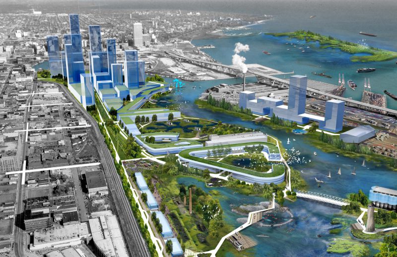
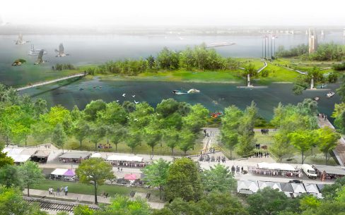
This Port District Planning Study is a pathway toward a new civic ecology for Milwaukee’s harborfront. It suggests restorative strategies that can be implemented over time to revitalize the harbor and set a new standard for waterfront development.
At the heart of Milwaukee’s nearly 1,000-acre Harbor District, three rivers—the Milwaukee, Menomonee, and Kinnickinnic—intersect with each other and with Lake Michigan. This connection zone consists of acres of post-industrial brownfields alongside an active marine and rail terminal, which continues to serve industrial activities, from motor works and machining to storage and chemical processing. It also results in two distinct harbor conditions: an “inner” condition established by the confluence of rivers and lake and a constructed land mass (Jones Island), and an “outer” condition created by the breakwater to the east. Mixed-use commercial and residential development exists just west of the inner harbor, with residential land uses in neighborhoods like Bay View to the south.
The Port District Planning Study proposes strategies for achieving habit restoration, more efficient port activities, sensitive urban development, and a mix of land and water uses that improve public access to the lake and to the city.
Waterfront Innovations Design Charrette
The Edge Effect master plan was developed in collaboration with Applied Ecological Services and Edgewater Resources for the Milwaukee Waterfront Innovations Design Charrette in October 2015. The Charrette was convened for the purpose of developing a new vision for the city’s Harbor District, with special attention paid to a 13.6-acre brownfield called the Wagon Works site that is adjacent to the University of Wisconsin–Milwaukee’s School of Freshwater Sciences. Formerly a rice marsh and currently a coal transfer depot, the Wagon Works site will be available for development in the near future as the city decommissions its coal-fired power plant.
Special thanks to Steven I. Apfelbaum of Applied Ecological Services, Greg Weykamp of Edgewater Resources, Daniel Adams and Lilith Fowler at the Milwaukee Harbor District Inc., and James Wasley at the UW-Milwaukee School of Architecture and Urban Planning.
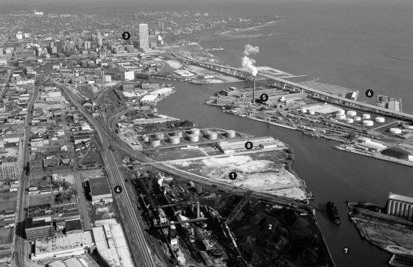
A Rusty-Gray Past
1 Wagon Works site
2 Coal coke site
3 Downtown Milwaukee
4 Canadian Pacific railway
5 Milwaukee Metropolitan Sewerage District
6 Port of Milwaukee
7 Kinnickinic River
8 UW-M School of Freshwater Science
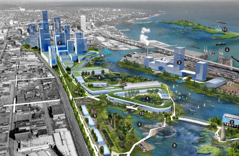
A Blue-Green Future
1 Water Works site
2 Housing attached to old grain silos
3 Housing and mixed-use commercial space
4 Expanded port operations
5 Open-air market at old coke site
6 Outdoor labs and research space
7 Commercial office space
8 Kayak corral
9 Wetland habitat
10 Festival grounds
11 Ecological breakwater
12 Outdoor theater
